
.jpg)
The Republic of Mordovia is located in the center of the East European, or Russian, plain between 42 ° 11 ' and 46 ° 45 °. east longitude and 53 ° 38 ' and 55 ° 11 °. northern latitude. It is approximately equidistant from the western, northern and southern seas. The maximum length from west to east is 298 km, from north to south - 140 km. The area of Mordovia is 26,112 km2.
The nature of the republic is characterized by high landscape diversity. Most of it is located in the forest-steppe of the layered high-altitude Privolzhskaya Upland, which in the west of the republic passes into the forest province of the Oka-Don lowland.
The territory enters the belt of a temperate climate with a well-marked change in the seasons of the year. The position of the republic in the sector of the temperate continental climate causes the instability of moistening: wet years alternate with arid years.
The republic is located on the southwestern periphery of the Volga basin in the interfluve of Moksha and Sura. Sura (the right tributary of the Volga) flows along the southeastern border, its main tributaries in Mordovia are Alatyr, Greater Ksh, Cheberchinka, Shtyrma, Me. Moksha (the right tributary of the Oka) flows along the western part of Mordovia, its basin includes Wad, Sivin, Issa, Satis, Urey, Urkat.
A combination of sod-podzolic, gray forest soils, and chernozems is observed in the structure of the soil cover. In natural vegetation, pine forests with an admixture of spruce, oak forests and meadow steppes predominate. The domination of forest-steppe landscapes favors the development of agriculture.
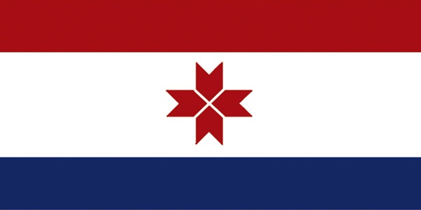
The territory of the settlement of the ancient Mordovians covered the Oka-Sur land between the rivers: from the right bank of the Volga in the north to the upper reaches of Moksha and Sura in the south. As a separate administrative-territorial unit, modern Mordovia appears in 1928 in the Mid-Volga region with the creation of the Saransk district, which in the same year is reorganized into Mordovia. This played an important role in the development of the economy and culture of the Mordvinian people, the growth of its national identity and marked the beginning of a new stage in state building. In 1930 the district was transformed into the Mordovian Autonomous Region; in 1934 - to the Mordovian Autonomous Soviet Socialist Republic; in 1990 - to the Mordovian Soviet Socialist Republic; in 1994 - to the Republic of Mordovia. State languages are Russian and Mordovian (Moksha and Erzya).
Mordovia is located almost in the center of the European part of the Russian Federation. It is adjacent to regions that are politically stable, with a similar ethnic and religious make-up - the Ryazan, Nizhny Novgorod, Ulyanovsk, Penza regions and the Chuvash Republic.
The Republic is distinguished by a developed national economic complex with diversified industry and agriculture; characterized by the permeability of space for investment. It is part of the Volga Federal District of the Russian Federation. The proximity of large industrial centers in Russia, good transport links with neighboring regions allow the use of imported raw materials and fuel, provide links for cooperation, sale of finished products.
The capital of Mordovia is the city of Saransk. Founded in 1641 as a fortress on the south-eastern outskirts of the Moscow kingdom, at present it is a political, economic, scientific and cultural center. The population, according to the estimate as of January 1, 2012, is 297.9 thousand people, with subordinate rural settlements - 326.1 thousand people.
As of January 1, 2011, there were 395 municipalities in the Republic of Mordovia, including: 1 city district, 22 municipal districts, 17 urban settlements, 355 rural settlements. The Saransk city district includes the city of the republican subordination Saransk, 3 urban-type settlements and 4 rural administrations, which are not endowed with the status of urban and rural settlements. In municipal areas, 507,449 people live, or 60.9% of the total population of the republic.
The nature of the republic is characterized by high landscape diversity. Most of it is located in the forest-steppe of the layered high-altitude Privolzhskaya Upland, which in the west of the republic passes into the forest province of the Oka-Don lowland.
The territory enters the belt of a temperate climate with a well-marked change in the seasons of the year. The position of the republic in the sector of the temperate continental climate causes the instability of moistening: wet years alternate with arid years.
The republic is located on the southwestern periphery of the Volga basin in the interfluve of Moksha and Sura. Sura (the right tributary of the Volga) flows along the southeastern border, its main tributaries in Mordovia are Alatyr, Greater Ksh, Cheberchinka, Shtyrma, Me. Moksha (the right tributary of the Oka) flows along the western part of Mordovia, its basin includes Wad, Sivin, Issa, Satis, Urey, Urkat.
A combination of sod-podzolic, gray forest soils, and chernozems is observed in the structure of the soil cover. In natural vegetation, pine forests with an admixture of spruce, oak forests and meadow steppes predominate. The domination of forest-steppe landscapes favors the development of agriculture.
The territory of the settlement of the ancient Mordovians covered the Oka-Sur land between the rivers: from the right bank of the Volga in the north to the upper reaches of Moksha and Sura in the south. As a separate administrative-territorial unit, modern Mordovia appears in 1928 in the Mid-Volga region with the creation of the Saransk district, which in the same year is reorganized into Mordovia. This played an important role in the development of the economy and culture of the Mordvinian people, the growth of its national identity and marked the beginning of a new stage in state building. In 1930 the district was transformed into the Mordovian Autonomous Region; in 1934 - to the Mordovian Autonomous Soviet Socialist Republic; in 1990 - to the Mordovian Soviet Socialist Republic; in 1994 - to the Republic of Mordovia. State languages are Russian and Mordovian (Moksha and Erzya).
Mordovia is located almost in the center of the European part of the Russian Federation. It is adjacent to regions that are politically stable, with a similar ethnic and religious make-up - the Ryazan, Nizhny Novgorod, Ulyanovsk, Penza regions and the Chuvash Republic.
The Republic is distinguished by a developed national economic complex with diversified industry and agriculture; characterized by the permeability of space for investment. It is part of the Volga Federal District of the Russian Federation. The proximity of large industrial centers in Russia, good transport links with neighboring regions allow the use of imported raw materials and fuel, provide links for cooperation, sale of finished products.
The capital of Mordovia is the city of Saransk. Founded in 1641 as a fortress on the south-eastern outskirts of the Moscow kingdom, at present it is a political, economic, scientific and cultural center. The population, according to the estimate as of January 1, 2012, is 297.9 thousand people, with subordinate rural settlements - 326.1 thousand people.
As of January 1, 2011, there were 395 municipalities in the Republic of Mordovia, including: 1 city district, 22 municipal districts, 17 urban settlements, 355 rural settlements. The Saransk city district includes the city of the republican subordination Saransk, 3 urban-type settlements and 4 rural administrations, which are not endowed with the status of urban and rural settlements. In municipal areas, 507,449 people live, or 60.9% of the total population of the republic.